How Long is the Distance of the Évora Aqueduct Hiking Route?
The distance of the Évora aqueduct hiking route is a common question for visitors to Portugal. This historic path offers a unique way to explore the Alentejo region on foot. You will walk alongside a massive stone structure built centuries ago. It is a perfect adventure for history lovers and nature enthusiasts alike.
Measuring the Distance of the Évora Aqueduct Hiking Route
For official information, visit Évora travel info.
You can find the latest updates on Évora travel info.
The total distance of the Évora aqueduct hiking route is exactly 8.3 kilometers for a one-way trip. Most walkers spend about three hours completing this scenic trek at a moderate pace. The trail is relatively flat and does not require advanced hiking skills. It follows the path of the water from the countryside into the city center.You should plan for a return journey if you do not use a taxi or bus. Walking back to the start doubles your total travel distance to over 16 kilometers. Many travelers choose to walk one way and take a quick ride back. This allows more time to explore the historic center walking routes in the afternoon.
The terrain consists mainly of packed dirt paths and some paved sections near the city. You will find the path easy to follow because the aqueduct is always in sight. There are very few steep inclines along the entire length of the route. This makes it an excellent choice for families with older children or casual walkers.
In 2026, the trail remains a top choice for outdoor activities in the region. Local authorities maintain the path to ensure it stays clear for all visitors. You can expect clear signage and well-kept surroundings throughout your hike. Always check the local trail conditions before you set out for the day.
History of the Água de Prata Aqueduct Trail
The Água de Prata aqueduct trail follows a masterpiece of 16th-century engineering. King João III ordered the construction to bring fresh water to the city. The famous architect Francisco de Arruda designed the massive stone arches. He also designed the famous Belém Tower located in Lisbon.
Construction began in 1531 and took six years to complete. The structure was built on top of ancient Roman foundations. It remains one of the few functional aqueducts from that era in Europe. Walking here feels like stepping back into the golden age of Portugal.
The aqueduct reaches heights of 26 meters in certain sections near the city. These towering arches allowed water to flow over valleys and uneven ground. You can see how the city grew around these massive stone pillars over time. Houses were even built directly into the arches in the historic center.
This landmark is now a recognized UNESCO World Heritage site. It represents the incredible skill of Renaissance builders in the Alentejo region. As you walk, notice the different styles of masonry used along the route. Each section tells a story of the labor required to build it.
Scenic Highlights Along the Hiking Path
The trail offers stunning views of the traditional Portuguese landscape. You will pass through vast groves of cork oak trees along the way. These trees are essential to the local economy and provide beautiful shade. The silver-green leaves create a peaceful atmosphere for your morning walk.
Springtime brings a carpet of colorful wildflowers to the fields near the path. You might see purple lavender and bright yellow daisies blooming in 2026. This season is also great for spotting local bird species like storks. Many storks build large nests on top of the highest aqueduct pillars.
- Massive stone arches that tower over the rural landscape.
- Traditional white-washed farmhouses with bright blue or yellow trim.
- Ancient Roman walls that once protected the city of Évora.
- Quiet streams that run parallel to the hiking trail sections.
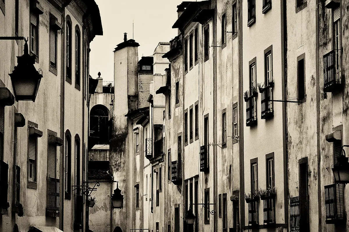
As you get closer to the city, the scenery changes to urban charm. The arches become part of the local streetscape in the Rua do Cano. You will see small gardens and cafes tucked beneath the historic stone. This transition from nature to history is a highlight for many hikers.
Practical Tips for Your 2026 Hiking Trip
🎯 Insider Tip: Discover the best Lisbon experiences with Viator Tours!
Preparation is key to enjoying the distance of the Évora aqueduct hiking route. The Alentejo sun can be very intense, even during the cooler months. You should carry at least two liters of water per person. There are no water fountains available once you leave the city limits.
Wear high-quality walking shoes or light hiking boots for the best experience. The dirt paths can be dusty in summer and muddy after winter rains. A wide-brimmed hat and sunscreen are essential for protection against UV rays. Consider bringing a light snack to enjoy at one of the scenic viewpoints.
The best time to start your hike is early in the morning. Temperatures are much more comfortable before the clock strikes noon. Many locals suggest starting by 8:00 AM during the hot summer season. This ensures you finish your walk before the peak heat of the day.
Check the weather forecast for Évora before you leave your accommodation. High winds can sometimes make the open sections of the trail more difficult. If a heatwave is predicted, it is better to stay in the city. You can find many other scenic walks in Evora 2026 that offer more shade.
Best Entry Points and Navigation Advice
Most hikers choose to start their journey at the Rua do Cano. This street is located inside the historic walls of the city. You can easily find the start by looking for the tall arches. Follow the aqueduct away from the center to begin the rural section.
The trail is officially marked as the PR1 EVR hiking route. Look for the standard red and yellow paint markings on posts or stones. These marks will guide you through turns and across small country roads. Navigation is simple since the aqueduct serves as a constant visual guide.
If you prefer a shorter walk, you can take a taxi to the trailhead. Ask the driver to drop you at the Quinta da Malagueira area. This allows you to walk back toward the city with the views. Many people find this direction more rewarding as the arches grow taller.
Public transport options are limited near the rural end of the trail. It is best to arrange a pickup if you do not want to walk back. Most local taxi apps work well in the Évora area for 2026. Ensure your phone is fully charged to use GPS maps during the hike.
Frequently Asked Questions
⭐ Recommendation: Don't miss out on amazing Lisbon tours - book now!
How long does it take to walk the Évora aqueduct trail?
It typically takes between 2.5 and 3.5 hours to walk the 8.3-kilometer route. Your total time depends on your fitness level and how often you stop for photos. You should learn how to hike the Agua de Prata aqueduct trail properly to manage your pace.
Is the Évora aqueduct hike difficult for beginners?
No, the trail is considered easy to moderate because it is mostly flat. The path follows the natural flow of water, so there are no steep hills. It is a great choice for casual walkers who enjoy historical sightseeing in nature.
Are there any entrance fees for the hiking route?
There are no fees to walk the distance of the Évora aqueduct hiking route. It is a public trail that is open to everyone throughout the year. You can enjoy the history and nature of the region for free in 2026.
The distance of the Évora aqueduct hiking route offers a perfect blend of history and exercise. Walking the 8.3 kilometers provides a deep connection to the heritage of Portugal. Plan your 2026 visit early to enjoy the best weather and scenery. Start your adventure today by exploring more scenic walks in Evora 2026.