Navigate the Rota Vicentina Fisherman's Trail Map for Sagres Area
Hiking in Sagres offers some of the most breathtaking views in Portugal. You need a Rota Vicentina Fisherman's Trail map for Sagres area to stay safe. This guide helps you navigate the rugged cliffs and sandy paths. Plan your perfect coastal adventure for 2026 with our expert navigation tips.
Overview of the Fisherman's Trail in Sagres
The Fisherman's Trail is a world-class hiking route in southern Portugal. It follows the wild Atlantic coast through the Alentejo and Algarve regions. Sagres marks a dramatic and beautiful point on this famous path. You will walk along high cliffs and secluded sandy beaches.
The terrain near Sagres is often sandy and very rocky. Proper navigation is vital for every hiker on these coastal paths. Use our Rota Vicentina trails in Sagres guide for more specific details. This section offers some of the best ocean views in all of Europe.
In 2026, the trail remains a top choice for nature lovers. Many visitors start their journey at the iconic lighthouse nearby. The path is narrow and hugs the cliff edge closely. Always keep a safe distance from the edge while taking photos.
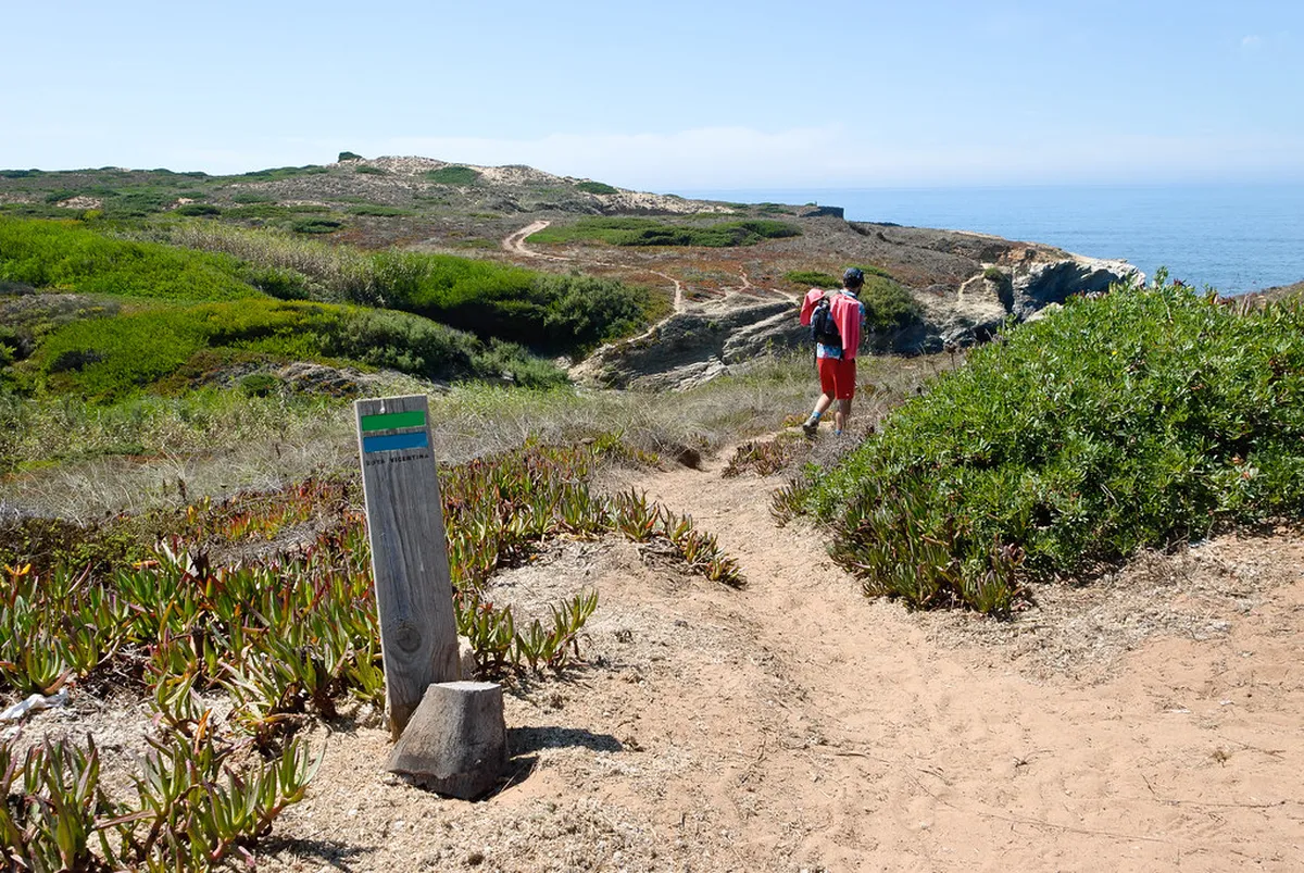
Local authorities maintain the trail to ensure hiker safety. You will see blue and green stripes on rocks and posts. These markers show you the correct way to go. Following these signs prevents you from getting lost in the scrubland.
Finding Your Rota Vicentina Trail Map
A detailed map shows elevation changes and important rest stops. You can find digital maps on the official Rota Vicentina website. Many hikers prefer using a GPS app on their smartphones. This helps you track your exact location in real time.
Local tourism offices in Sagres also provide helpful paper maps. These maps highlight water points and emergency contact numbers. Having a physical backup is wise if your phone battery dies. You can also find maps in local bookstores in the town center.
The Sagres section connects the town to the famous Cabo de São Vicente. This specific route covers about 6 kilometers of stunning coastline. Most hikers complete this walk in two to three hours. It is one of the most popular scenic walks in Sagres 2026 for day trippers.
Check your map regularly to find the best lookout points. Some hidden paths lead down to very quiet beaches. Only use these side trails if the map shows they are safe. Erosion can make some unofficial paths very dangerous for hikers.
Key Landmarks on the Sagres Trail Section
Your journey often begins at the iconic Cabo de São Vicente lighthouse. This is the southwesternmost point of mainland Europe. The Cabo de São Vicente coastal walk is a truly unforgettable experience. You will see massive waves crashing against the limestone rocks.
As you head east, you will pass the beautiful Beliche Beach. This small cove is perfect for a quick resting break. The cliffs here reach heights of over 50 meters. Look out for rare birds nesting in the rock faces.
The historic Sagres Fortress marks the end of this trail section. This site is famous for its links to Portuguese maritime history. You can walk around the massive perimeter walls for great views. It is a must-visit spot for any hiker in the area.
The Sagres Fortress walking guide 2026 provides more details on this landmark. Entry to the fortress costs about 3 Euros per person. The grounds feature a giant wind compass made of stone. This is a perfect place to finish your coastal trek.
Practical Tips for Hiking Near Sagres in 2026
💡 Pro Tip: Book your Lisbon adventures in advance through Viator for the best deals!
Hiking in Sagres requires preparation for the constant Atlantic wind. These breezes can be very strong even on sunny days. Carry at least two liters of water during the summer months. Sunscreen is essential because the sea breeze hides the heat.
Wear sturdy hiking boots to handle the uneven and rocky ground. Sneakers might not provide enough grip on the sandy cliff paths. Most trail sections are free for the public to access. Always tell someone your planned route before you start walking.
- Check the local weather forecast for wind warnings.
- Carry a portable power bank for your mobile devices.
- Pack a light windbreaker jacket even in the summer.
- Stay on the marked paths to protect local plants.
Public buses run between Sagres and the lighthouse several times daily. A one-way ticket costs approximately 2.50 Euros in 2026. This allows you to hike one way and ride back. Check the latest schedule at the Sagres bus stop.
Frequently Asked Questions
Where can I download a Rota Vicentina Fisherman's Trail map for Sagres area?
You can download the official map from the Rota Vicentina website. Many hikers also use the AllTrails app for GPS navigation. Local tourist offices in Sagres provide free paper maps for visitors. These maps show the blue and green markers clearly.
How long is the trail from Sagres to Cabo de São Vicente?
The trail section is approximately 6 kilometers long. Most people take about 2 to 3 hours to finish it. This time includes stops for photos and enjoying the views. The path is mostly flat but features some sandy sections.
Are there any fees to hike the Fisherman's Trail in Sagres?
No, the Fisherman's Trail is free for everyone to enjoy. You do not need a permit to hike this route. However, you might pay a small fee to enter the fortress. Local buses back to town also require a small fare.
Using a Rota Vicentina Fisherman's Trail map for Sagres area ensures a great trip. The stunning cliffs and historic sites make this a top 2026 destination. Grab your gear and explore the wild beauty of Portugal today. Always respect the natural environment while you enjoy your coastal walk.