Essential Five Lakes Trail Zermatt Map and Directions
The Five Lakes Trail is a famous hike in Switzerland. You will see the Matterhorn reflected in beautiful alpine waters. Our Five Lakes Trail Zermatt map and directions help you find every scenic spot. This guide ensures you have a smooth journey in 2026.
How to Reach the Five Lakes Trailhead
Most hikers start this journey at the Blauherd mountain station. First, walk to the Sunnegga-Rothorn valley station in Zermatt. You can find this station at the end of the town. It is a short walk from the main train station.
Buy a ticket for the funicular and the cable car ride. A round-trip ticket costs about 50 CHF in 2026. Check the start location details for the latest prices. The funicular runs frequently throughout the summer season.
Take the funicular up to the Sunnegga station first. Then, transfer to the cable car heading toward Blauherd. The entire journey takes about 20 minutes from the valley. Exit the cable car at Blauherd to find the trail start.
Five Lakes Trail Zermatt Map and Directions
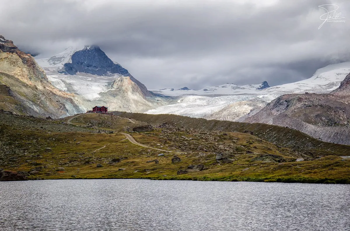
The trail begins with a short walk to Stellisee. This lake offers the most famous Matterhorn reflection. Follow the wide gravel path downhill from the Blauherd station. The walk takes about 20 minutes to reach the water.
Next, follow the signs toward the hidden Grindjisee. This lake is surrounded by larch trees and wildflowers. The path becomes narrower and slightly more rugged here. It is a perfect spot for a quiet mountain break.
Continue your journey toward Grünsee and the milky Moosjisee. Grünsee features clear water and rugged mountain views. Moosjisee has a unique blue color from glacier water. These sections show the diverse beauty of the scenic walks in Zermatt.
The final stop is Leisee near the Sunnegga station. This lake is very popular with families and swimmers. You can take the funicular back to Zermatt from here. This route covers approximately 9 kilometers in total distance.
Navigating Trail Markers and Signage
Finding your way is easy with the yellow trail markers. These signs list the Five Lakes Trail by name. They also show the estimated walking time to each lake. Always follow the arrows pointing toward the Sunnegga station.
We recommend downloading a digital map before you start. Mobile signals can be weak in some mountain areas. A map helps you stay on the official path easily. You can find more difficulty information to plan your pace.
Local paper maps are also available in Zermatt town. Visit the tourism office near the train station for help. These maps show all the hiking paths in 2026. Keep an eye on the weather while you navigate the trail.
Practical Logistics for Your 2026 Hike
💡 Pro Tip: Book your Zermatt adventures in advance through Viator for the best deals!
The best time for this hike is June to October. Snow often covers the trail during the late spring months. July and August offer the warmest temperatures for walking. Start your hike early to avoid the largest crowds.
Pack plenty of water and snacks for your journey. There are few places to buy food along the trail. Wear sturdy hiking boots with good ankle support. The terrain includes rocky paths and some steep descents.
Check the lift schedule before you leave Zermatt town. The last funicular usually departs Sunnegga around 5:00 PM. Missing the last ride means a long walk home. Use these photography tips to capture the best mountain light.
Frequently Asked Questions
How long does the Five Lakes Trail take?
The hike usually takes 2.5 to 4 hours to complete. This time depends on how long you stop at each lake. Most hikers spend about 3 hours on the trail. Allow extra time for photos and a picnic lunch.
Is the Five Lakes Trail Zermatt difficult to navigate?
No, the trail is well-marked and easy to follow. You will see many yellow signs along the route. The path is mostly downhill when starting from Blauherd. It is suitable for most hikers with basic fitness levels.
Are there toilets on the Five Lakes Trail?
Toilets are only available at the mountain stations. You can find them at Blauherd and Sunnegga. There are no public restrooms located at the lakes. Plan your breaks accordingly before you start the hike.
The Five Lakes Trail is a must-do activity in Zermatt. Use our map and directions to enjoy the best views. This guide helps you navigate the path safely in 2026. Grab your hiking boots and start your Swiss adventure today!