Hiking Uetliberg from Zürich City: A Complete 2026 Guide
Are you looking for a nature escape near the urban center? Learning how to hike Uetliberg from Zürich city is very easy for most visitors. This guide covers the best trails for your planned 2026 mountain visit. You will enjoy stunning views of the Alps and Lake Zürich from the peak.
Best Routes for Uetliberg Mountain Hiking Trails
For practical details and last-minute changes, use Zürich official info.
The Denzlerweg is the most direct path to reach the summit from the city center. This trail starts near the Albisgütli tram stop which is easy to find by foot. This specific route is quite steep but it is well-maintained for all active hikers. You will walk through lush forests and enjoy the fresh mountain air during your climb.The Hohensteinweg offers a gentler climb which is perfect for casual walkers and small families. It provides much more shade during the warm summer months compared to other steep paths. Most hikers can complete this scenic route in about one hour at a steady pace. It is one of the most popular Uetliberg mountain hiking trails for local residents.
Always check the current trail conditions before you start your journey into the Swiss forest. Heavy rain can make some paths very muddy and slippery for those without proper boots. You should wear sturdy shoes with a good grip to ensure your safety and comfort. These mountain trails are clearly marked with yellow signs to help you find your way.
Essential Preparation for Your 2026 Hike
Zürich weather can change very quickly even during the warm summer season in the Alps. You should pack a light rain jacket and extra layers of clothing for the summit. Bring at least one liter of water to stay hydrated during your steep mountain climb. You can refill your water bottles at many public fountains located throughout the city center.
Download a local map or use a reliable GPS app to track your hiking progress. The paths are well-marked but digital maps will help you with navigation in the woods. Tell a friend about your planned route before you leave the city for the day. Safety is always important when you are exploring the beautiful Swiss mountains on your own.
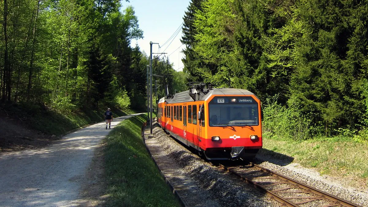
Check the local train schedule for your return trip before you start your long hike. The S10 train runs frequently from the mountain top back to the main train station. This is very helpful if you feel tired after hiking up the steep mountain paths. You can compare the Uetliberg mountain train vs walking up options for your 2026 trip.
How to Hike Uetliberg from Zürich City Center
Take tram line thirteen to the Albisgütli station to reach the base of the mountain. This is the main starting point for many hikers who want to reach the summit. The journey from the main station takes about twenty minutes on the local public transport. Use a standard zone one hundred and ten ticket for this short and easy trip.
You can also take the S10 train to the Triemli station for a different route. This station provides easy access to the Hohensteinweg trail which is a very popular path. Follow the yellow signs pointing toward the mountain peak from the exit of the station. The walk from the train platform to the actual trailhead is very short and simple.
Consider walking from the city center if you have plenty of time for your adventure. Start your journey at the Lake Zürich promenade walks to enjoy the best water views. This scenic detour adds about thirty minutes to your total hiking time for the day. It is a fantastic way to see more of the city before you start climbing.
What to See at the Uetliberg Summit
🌟 Local Expert Tip: Get the most out of your Zurich visit with guided tours!
The summit offers a full panoramic view of the entire region and the distant mountains. You can see the whole city of Zürich and the lake from the viewing deck. The snow-capped Glarus Alps appear very clear on sunny days during the spring and summer. It is truly the perfect spot for taking beautiful travel photos to share with friends.
Visit the Uetliberg lookout tower for an even higher view of the surrounding Swiss landscape. Climbing the metal tower costs a small fee for visitors during the 2026 travel season. The platform stands exactly eight hundred and seventy meters above the sea level right now. You will find the best Uetliberg panoramic viewpoint located at the very top.
Enjoy a delicious meal at the Hotel Uto Kulm restaurant after your long mountain hike. They serve traditional Swiss dishes like cheese fondue and crispy potato rosti all year long. The outdoor terrace is open for guests during the warm summer and spring months. It is a rewarding way to end your hike before heading back down.
Frequently Asked Questions
Is the hike up Uetliberg difficult for beginners?
Hiking Uetliberg is generally considered moderate and suitable for most people with basic fitness levels. Some sections are steep but the paths are very well-maintained for safety and easy walking. Beginners should choose the Hohensteinweg for a more comfortable and gradual climb up the mountain.
How long does it take to hike Uetliberg from the tram stop?
The hike from the city tram stop to the summit usually takes about one hour. This depends on your pace and which specific trail you choose for your mountain ascent. Allow extra time to enjoy the views and take photos at the various scenic lookouts.
Can I hike Uetliberg during the winter months?
You can hike Uetliberg in winter but you must be careful of ice and snow. The paths can become very slippery during the cold months from December through to February. Wear warm clothing and shoes with excellent traction to ensure you stay safe on the trails.
Knowing how to hike Uetliberg from Zürich city allows you to enjoy Swiss nature easily. Follow the marked trails and prepare for the weather to have a great 2026 trip. Start your journey today by checking the local tram and train schedules for your adventure.